Dark Heart PTR Development Notes
 Dark Heart PTR Development Notes
 The War Within Alpha - Isle of Dorn Main Story Quest Preview
 Are we approaching a Solo Raid WoW Experience?
 MMO-Champion


It's not so much "technology" for the most part. There are some plants (there's a type of fern, off the top of my head) that lock-in a high amount of carbon as they grow, and live a long time. They absorb that carbon out of the atmosphere; that's why plants "breathe" carbon dioxide, in the first place. So the idea is you grow massive fields of these ferns in areas that are normally arid or inhospitable (one proposal was the newly-unfrozen permafrost areas in the Arctic).Originally Posted by Nasuuna

You're not going to make an appreciable effect with a couple farms of this stuff, though, which is where you get into the massive infrastructure costs.
 Recent Blue Posts
 Recent Forum Posts
-
2017-06-30, 10:55 PM #21I Don't Work Here


- Join Date
- Feb 2010
- Location
- Ottawa, ON
- Posts
- 79,169

-
2017-06-30, 10:55 PM #22Titan

- Join Date
- Jul 2010
- Location
- Under the stars
- Posts
- 12,993
We could but more likely it will be this because people will keep denying it :P Originally Posted by PrimaryColor
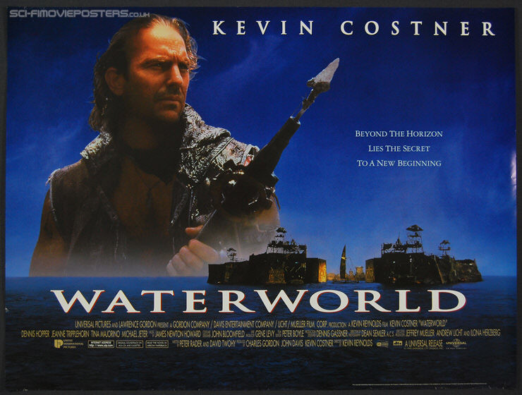
I am just saying when a crazy Dennis Hopper starts becoming a post apocalyptic pirate, you know we have problems :PI love Warcraft, I dislike WoW
Unsubbed since January 2021, now a Warcraft fan from a distance
-
2017-06-30, 11:01 PM #23Banned

- Join Date
- Sep 2010
- Location
- United States of America
- Posts
- 7,995
I say, let the sea levels rise. I go fishing every couple of weekends.
-
2017-06-30, 11:03 PM #24The Unstoppable Force


- Join Date
- Feb 2015
- Location
- California
- Posts
- 21,877
First we need to deal with more pressing issues. Like building the wall and securing the border. Originally Posted by Didactic
-
2017-06-30, 11:03 PM #25Epic!


- Join Date
- May 2017
- Location
- Denver
- Posts
- 1,537
Neat. Even if one person everywhere plant one, it'd probably make a slight effect Originally Posted by Endus
-
2017-06-30, 11:07 PM #26The Unstoppable Force
- Join Date
- Feb 2015
- Location
- California
- Posts
- 21,877
Waterworld isn't comparable to Earth though, because most land is above the 220ft sea increase upper limit. Originally Posted by Orby
-
2017-06-30, 11:18 PM #27Warchief
- Join Date
- Oct 2010
- Location
- Azeroth
- Posts
- 2,110
So what year do you predict the polar ice caps melt and Florida will be under water? I forgot what Gore and his scientist predictions were but since it never happened people moved on to other climate change saviors. Just curious when you think the world is going to come to it's fire and brimstone. Due to all the wrong speculations over the years Scientist have been pushing it for a hundred years or so in the future to move the goal post a little more. I believe you're probably in that area. Couple hundred years? Originally Posted by Endus
- - - Updated - - -
You know how I know you don't live in America. Didn't you guys just do a brit exit for one of the reasons because of the refugee issues? The Brits I talk to say they voted for it because of that and to make your government more accountable instead of blaming everything on the EU. Originally Posted by UnifiedDivide
-
2017-06-30, 11:19 PM #28Banned
- Join Date
- Aug 2011
- Location
- Jersey shore night club
- Posts
- 1,891
Plant life Originally Posted by Nasuuna
-
2017-06-30, 11:24 PM #29Warchief
- Join Date
- Oct 2010
- Location
- Azeroth
- Posts
- 2,110
In all seriousness as a Conservative I want to see the planet be healthy. I just believe the Paris Treaty was a boot up the ass to America. Americans would have to reduce their carbon foot print by 26%, while China, and other 3rd world countries could up their's (Can't remember the figure but it was ridiculous) with no oversight on them (Like they give two shits after the deals done to fix anything) Plus the American tax payer would be on the hook for billions of dollars to said 3rd world shit holes over the coarse of a decade. All to reduce the climate by less than a percentage. Originally Posted by Shadee
Americans would get hammered on this deal. On the coal side which would lose thousands of coal jobs. Even Obama was for clean coal before he was against it. My wife who works for a coal burning plant said the price of energy would go up astronomically. This deal would HAMMER the middle class here in America.
I know what some on here will say, but what it all boils down to Fuck America. That's all I hear when I argue this stuff with the left. The only people who are for this is ones who want to see America burn.
I want to see a better deal where EVERYONE chips in. Not just mainly America.Last edited by Deathcries; 2017-06-30 at 11:27 PM.
-
2017-06-30, 11:26 PM #30Banned
- Join Date
- Jun 2011
- Location
- US
- Posts
- 17,229
Quick, someone call dennis quad and jake gillenhall.
-
2017-06-30, 11:29 PM #31Banned
- Join Date
- Aug 2011
- Location
- Jersey shore night club
- Posts
- 1,891
I agree with you, I was just giving a smart ass answer to that person's question. The Paris Treaty was a shit deal for the US but of course we are still the villain for the "blame America" crowd. Originally Posted by Deathcries
-
2017-06-30, 11:29 PM #32Banned
- Join Date
- Jun 2011
- Location
- US
- Posts
- 17,229
Pretty much nails it on the head. Originally Posted by Deathcries
The Paris agreement was non-binding. We would give all this money to the shitholes of the earth, with little to no accountability and no mechanism to penalize a country for not upholding their commitments.
I've always felt that if leftists were truly serious about addressing climate change, they would be steadfast advocates for safe, dependable, and cost effective nuclear power.
for the most part though, they use the excuse of climate change to advocate policies which would adversely effect the American economy, while giving freebees to other countries.
-
2017-06-30, 11:32 PM #33Warchief
- Join Date
- Oct 2010
- Location
- Azeroth
- Posts
- 2,110
Well you already had that vote. Sorry your side lost. Over 60% of illegals come across the border. If we shut down even half of that with a wall I'd be happy. Nothing says stay the fuck out then a big sized wall surrounding your country. Originally Posted by UnifiedDivide
- - - Updated - - -
Ayup. I'm all about clean energy and making things better. There could have been much better ways of doing so then the Paris Climate accord. All that was, was a big fuck you to the American people. This is why we have Trump now. All Trump is, is a big middle finger to the left, and to corrupt government. That's why a lot of Americans voted him in. Originally Posted by supertony51
-
2017-06-30, 11:32 PM #34Banned
- Join Date
- Aug 2011
- Location
- Jersey shore night club
- Posts
- 1,891
Not only are those more pressing issues but they are actually real issues. Originally Posted by PrimaryColor
-
2017-06-30, 11:35 PM #35Warchief
- Join Date
- Oct 2010
- Location
- Azeroth
- Posts
- 2,110
I want to see a good deal. If we're to believe the climate scientist as Endus would like us to take their word for, then we're already done for. This world is done in about 100 years unless we go carbon negative. Not just America, but the entire world. Ain't going to happen. Originally Posted by Shadee
-
2017-06-30, 11:40 PM #36I am Murloc!

- Join Date
- Mar 2010
- Posts
- 5,568
There already several technologies being used that convert CO2 in the atmosphere into other products such as fuel and fertilizer. Originally Posted by Nasuuna
https://www.sciencealert.com/a-canad...t-into-pellets
https://www.fastcompany.com/40421871...climate-change
http://www.iflscience.com/environmen...to-fertilizer/
-
2017-06-30, 11:41 PM #37Banned
- Join Date
- Aug 2011
- Location
- Jersey shore night club
- Posts
- 1,891
Yeah, people like that talking about "being past the tipping point" in terms of CO2 levels are just laughably ignorant. Originally Posted by Deathcries
-
2017-06-30, 11:42 PM #38I am Murloc!
- Join Date
- Mar 2010
- Posts
- 5,568
The Paris Treaty was custom written specifically for the US, and agreed to everything the US wanted in the treaty. Trump simply wants to remove any and everything he can that was done under Obama. Originally Posted by Shadee
-
2017-06-30, 11:43 PM #39Warchief
- Join Date
- Oct 2010
- Location
- Azeroth
- Posts
- 2,110
Immigration can be good up to a certain extent. When big businesses uses it instead of paying their fellow countrymen proper wages of what the job is worth, because it's cheaper, that's a form of slave labor. I'm against that. Originally Posted by UnifiedDivide
A lot of big businesses do that. If you have to pay people better wages then raise the price of the product. If people can't afford that price because they're trying to be greedy then I guess that place goes out of business and someone else picks up the slack. Market demand.
Yes I'm conservative, but I'm also a nationalist. Once we no longer have poor people relying off of government hand outs and the majority of my countries working, and you still need workers, then immigration isn't a bad thing.Last edited by Deathcries; 2017-06-30 at 11:46 PM.
-
2017-07-01, 12:02 AM #40Banned
- Join Date
- Aug 2011
- Location
- Jersey shore night club
- Posts
- 1,891
Shouldn't this thread be in the politics sub forum? Climate change is really more of a political "issue" than a scientific or any other issue.
- - - Updated - - -
There might be some truth to Trump wanting to undo a lot of things under Obama but it was still a bad deal for the US. Originally Posted by Gorgodeus
- - - Updated - - -
Yup, America first. Let's get our own off relying on government hand outs first. We actually cause a disservice to other nations when we allow their best and brightest to come to the US, those people should stay in their own countries to help build a better future there. Can't blame them on wanting to come to the US though! Originally Posted by Deathcries
Last edited by Shadee; 2017-06-30 at 11:59 PM.


 Reply With Quote